Accurate and reliable wind analysis
State of the art wind-assessment for your projects
Analyze wind speeds, turbulences, wind comfort and safety to create pedestrian-friendly spaces.
How it works
Professional wind assessment in three simple steps
Run a wind assessment in a few clicks, no coding skills or complex setup required.
-
1. Configure your settings
Type in name, select number of wind directions you want to analyze, and set the geographic position of your project.
-
2. Upload your models
Upload STL or OBJ files for the main building/buildings, surrounding buildings, terrain, and optionally vegetation.
-
3. Analyze the results
Explore through interactive 3D visualizations the results of your wind assessment and download a PDF report ready to be submitted to the authorities.
Features
All you need for a complete wind assessment
Explore a wide range of features giving you the power to analyze all aspects of wind comfort and safety.
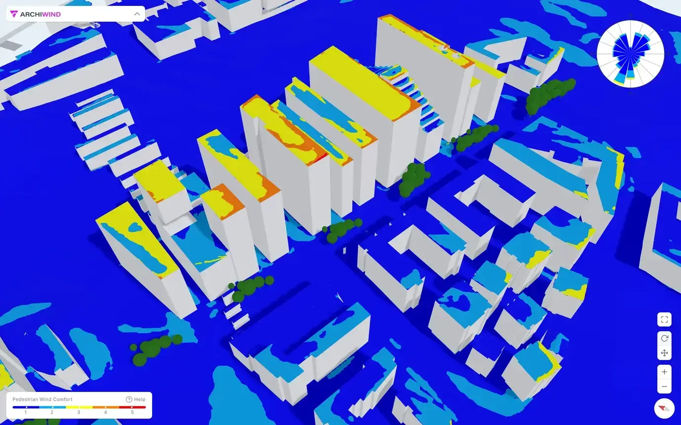
Comfort Map
The Lawson wind comfort criteria classify the conditions based on the associated "comfortable" activity using the wind simulations and wind statistics for the area.
- Analyze pedestrian wind comfort
- Identify frequently windy and calm areas
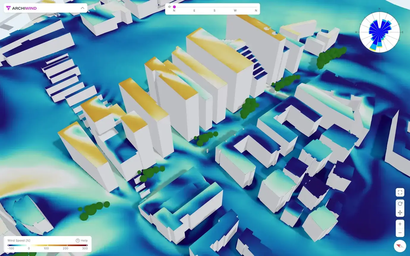
Wind Speed Map
The wind speed from each direction in percentage of regional reference wind speed at 10m height, typically given in the weather forecasts.
- Identify wind directions causing wind acceleration or sheltering locally
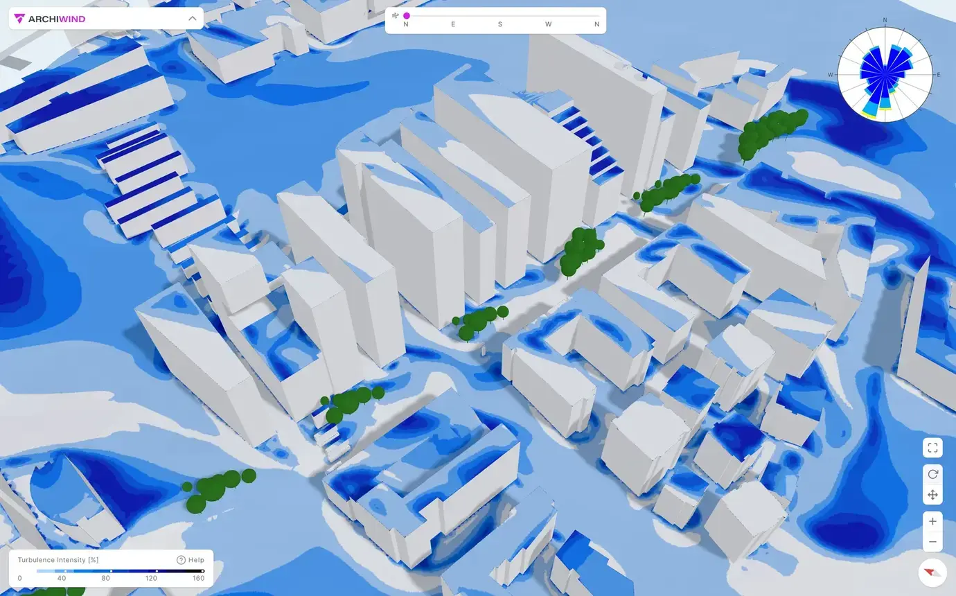
Turbulence Intensity Map
The turbulence intensity provides insights into the fluctuations and variations in wind speed.
- Identify areas of high turbulence
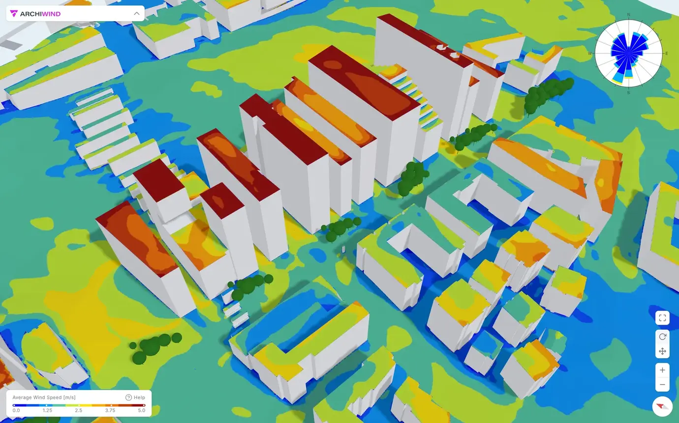
Average Wind Speed Map
The average wind speed is calculated based on the wind simulations and local wind statistics.
- Identify areas of frequently high and low wind speeds, complementary to the Pedestrian Wind Comfort Maps
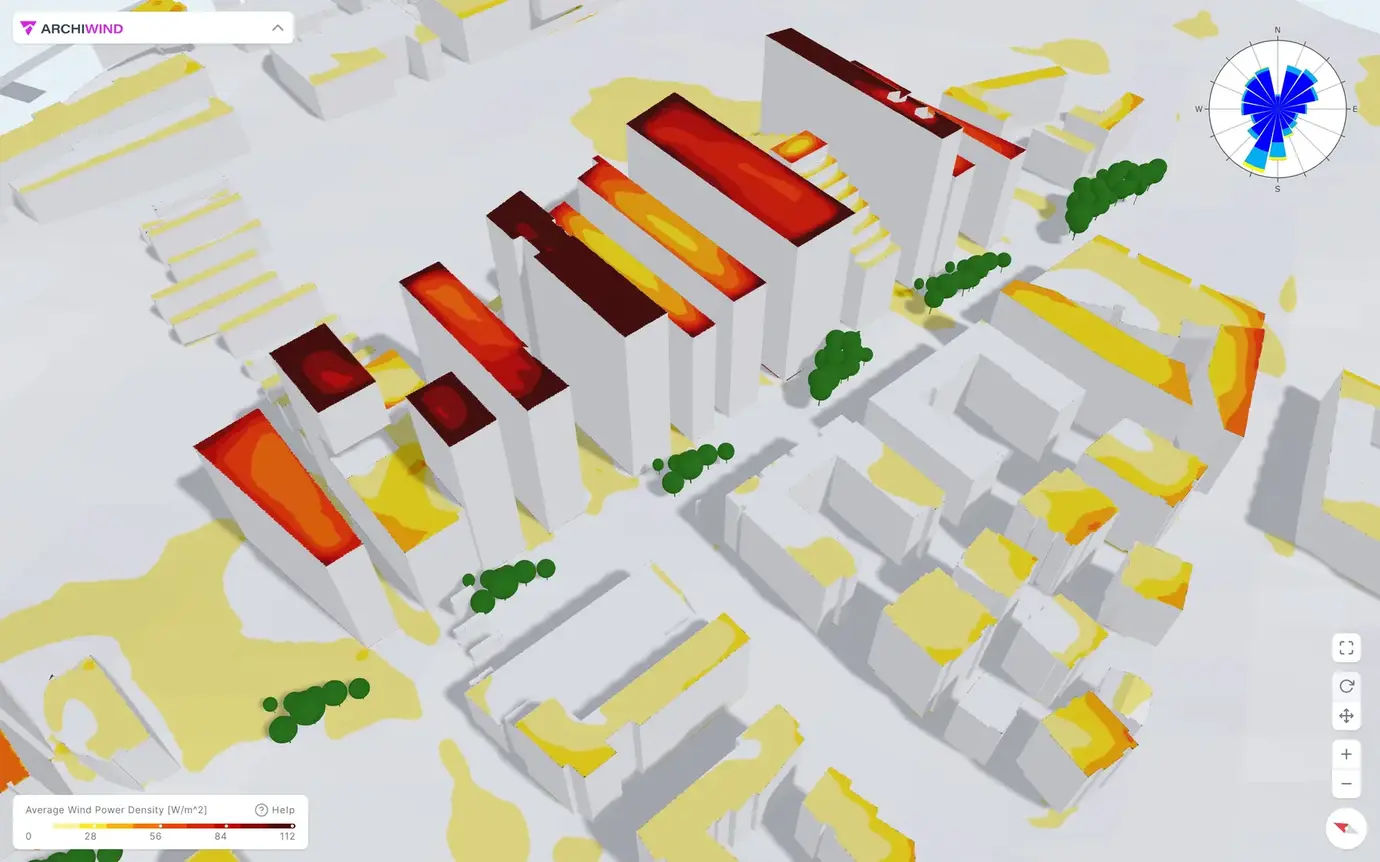
Average Wind Power Density Map
The average wind power density represents the wind power per unit area and is calculated based on the wind simulations and local wind statistics.
- Find the optimal placement of an urban wind turbine and evaluate its feasibility
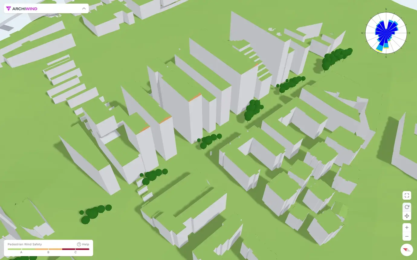
Wind Safety Map
The NEN 8100 standard classifies the wind safety risk based on how frequently one can expect the wind to exceed 15 m/s using the wind simulations and wind statistics for the area.
- Reveal possibly dangerous wind conditions
And more
Everything included in the platform
ArchiWind is built on years of extensive research by academic experts specializing in urban winds
and our experience working on numerous industry projects.
Automated wind statistics retrieval
Wind statistics for your location are retrieved from ERA-5 and other accurate historical wind statistics datasets.
3D visualisation of the data
Freely move around in your model and explore how wind affects your site in an interactive 3D viewer.
Fully automated report
Generate a fully automated report with data, images and charts, presenting the detailed results from your simulation.
Up to 32 wind directions
Investigate the fields from 8, 16, or 32 wind directions, and increase the accuracy for the aggregated or averaged maps.
Export data for additional analysis
All wind-assessment raw and processed data can be exported to perform additional custom analysis or integrations.
Data sharing
Your data is kept safe, but you can easily share assessments with your team and protect them with a password.
Pricing
Get in touch to discuss your pricing options
We will customise your pricing based on your requirements.
-
Run wind simulations with 8, 16 or 32 wind directions
-
Access to our intuitive results page
-
Export PDF report of the results
-
Download processed data
-
Download raw simulation data
-
API access
Start your 30-days free trial
Book a demo
Want to learn more about our platform?
Book a demo with us to learn about the benefits of using ArchiWind to validate your projects.
From the blog
Latest posts
New features, research studies and news from ArchiWind.

ArchiWind: From Research to Commercialization
How ArchiWind became the tool it is today after years of research.


Paradise project - a Stavanger Kommune success story
Wind can have long-term effects on architecture, urban development, and real estate industries.

Investigating the Possibility of a Big Jump for Freestyle Skiing and Snowboarding at Granåsen Ski Centre
How NablaFlow's CFD Investigation Provided Valuable Insight for Trondheim Kommune's Decision Making Process.
Frequently Asked Questions
Common questions related to our billing plans.
Still have questions?
Contact
Get in touch
Please fill this form and we'll get back to you as soon as possible.